Add original arrangements
Create a train map with an original arrangement, such as adding a fictitious limited express train.
Display route map
Press the button to create a route map with the selected conditions.
Create other types of route maps for the Nankai Main Line [Izumisano to Wakayamashi]
Create other types of train maps.
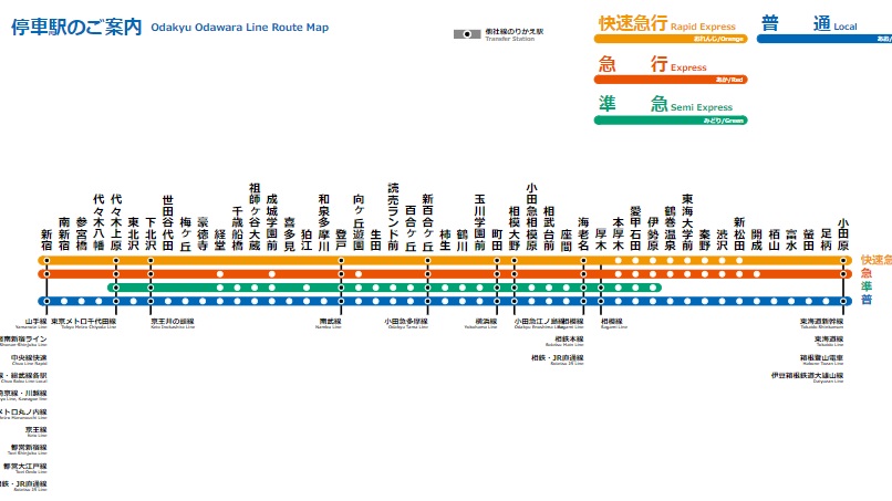 TYPE-A
 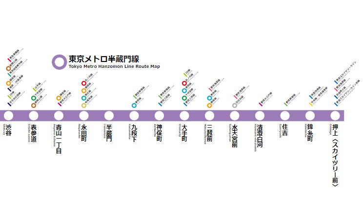 TYPE-C
 Create a wide-area route map
You can create a wide-area route map that arranges Nankai Main Line [Izumisano to Wakayamashi] stations on the map. In addition to the Nankai Main Line [Izumisano to Wakayamashi], combinations of multiple routes are also possible. Please use it when you want to highlight multiple routes on the map.
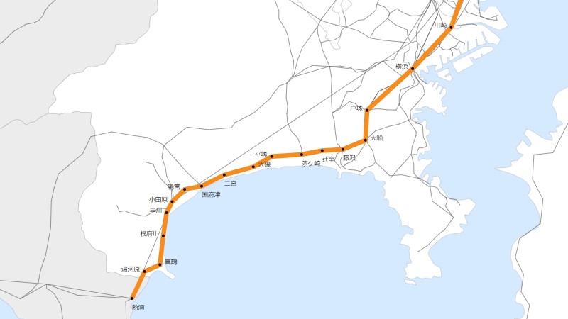 Create a wide-area route map
 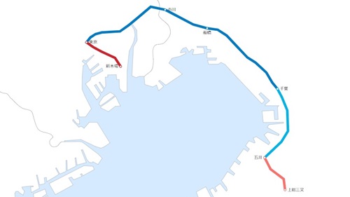 Create a transit map