ENGLISH | JAPANESE
Japanese railway map creation site
-
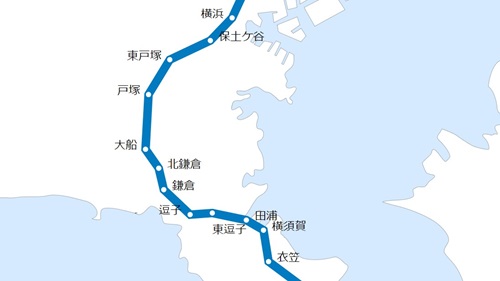
Customize the railroad map
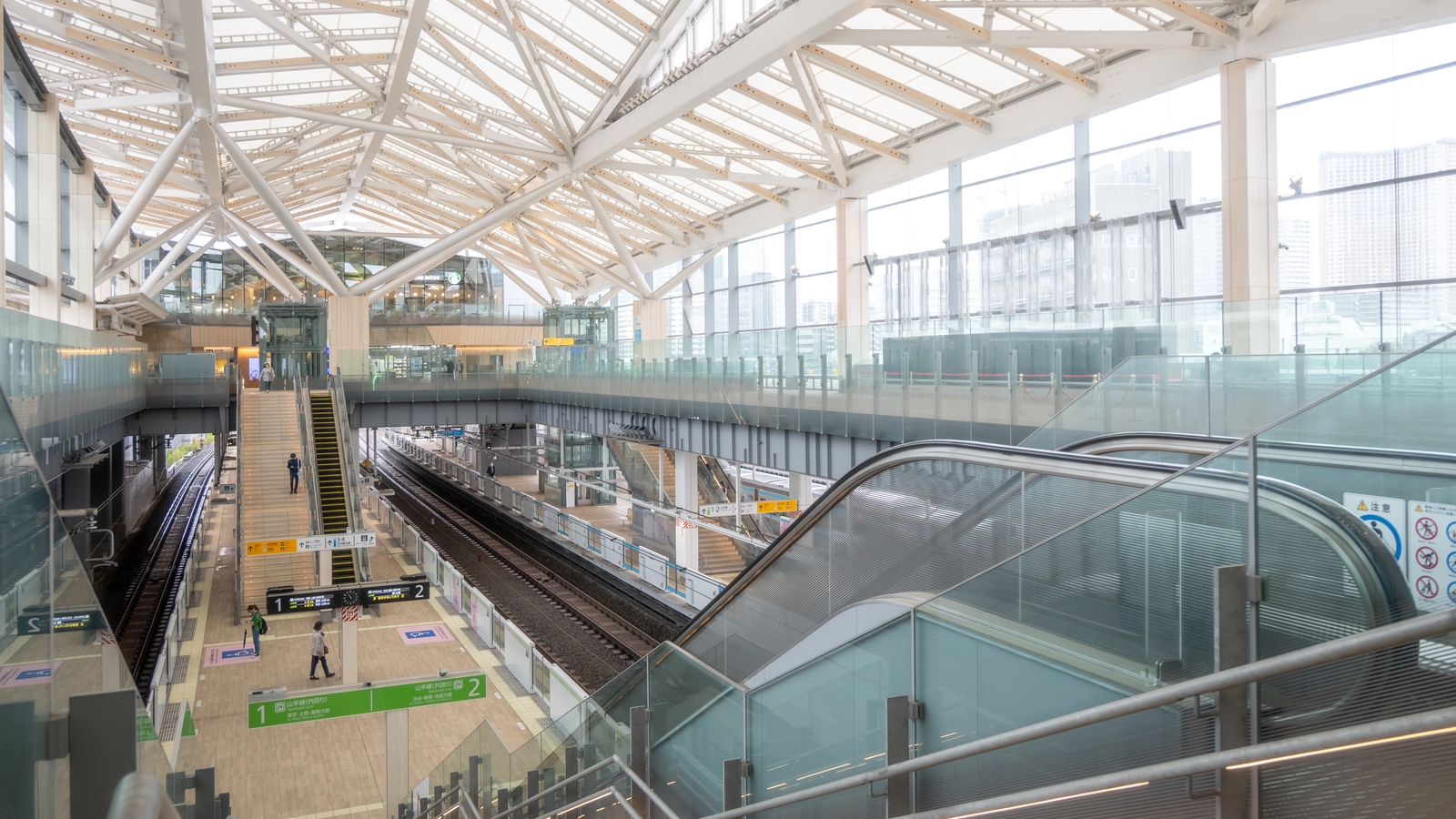
For example, if you want to make only the JR Yokosuka line stand out, or if you want to create a route map in Chiba prefecture, we will fulfill your request.
-
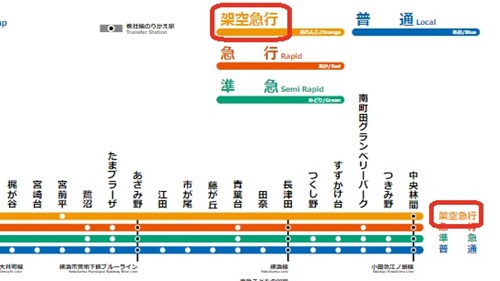
Add fictitious express
You can add your own fictitious original express that does not exist in this world to the route map.
-
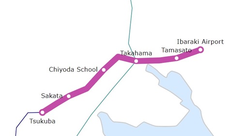
Add a fictitious new railroad
A railway line that does not exist in this world is easily reflected on the map with just a click or a tap.
Supports multiple languages
The site supports Japanese and English. You can select Kanji, Hiragana, or Latin Alphabet for the station name display.
-
Site supports English
The site supports Japanese and English. You can select kanji, hiragana, or romaji (ratin alphabet) for the station name display.
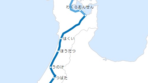
-
Hiragana display
All station names can be displayed in hiragana. It is also possible to visualize station names that are difficult to read, and to create route maps for children.
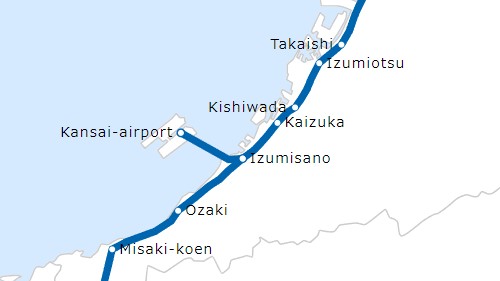
-
Alphabet display
All lines and station names can be displayed in latin alphabet. You can also customize and create route maps for overseas.
![Image of no cost](image/top-priceless.jpg)
Of course it's free
Even if you don't have design knowledge or skills, or don't have a Photoshop or Illustrator, you can create an original route map on this site. It is free of charge. Easy to operate. Just follow the on-screen instructions and you can create a route map in just a few minutes.
Let's create a route map
Please select the prefecture for which you want to create a route map. When creating a wide-area route map that spans prefectures, first select the prefecture that will be the starting point.
Hokkaido and Tohoku region
It is an area with many routes of JR Hokkaido and JR East. It has the largest number of Shinkansen lines in Japan, with four lines: the Hokkaido Shinkansen, the Tohoku Shinkansen, the Akita Shinkansen, and the Yamagata Shinkansen. Compared to other areas, the number of active lines is slightly less, but the number of discontinued lines is quite large. Especially in Hokkaido, there are many abandoned railway lines.
Create a railway route map of Hokkaido prefecture
Create a railway route map of Aomori prefecture
Create a railway route map of Iwate prefecture
Create a railway route map of Miyagi prefecture
Create a railway route map of Akita prefecture
Kanto region
It is the area with the most train lines in Japan. In addition to JR East, there are many routes of major private railway companies such as Tobu, Seibu, Tokyu, and Keisei. Tokyo and Kanagawa used to have streetcars and trolleybuses. Therefore, the number of abandoned lines is quite large.
Create a railway route map of Ibaraki prefecture
Create a railway route map of Tochigi prefecture
Create a railway route map of Gunma prefecture
Create a railway route map of Saitama prefecture
Create a railway route map of Chiba prefecture
Koshinetsu and Hokuriku region
This is the inland area and Sea of Japan side area of the Chubu region. Niigata Prefecture has many JR East routes, and other prefectures have many JR West routes. The Hokuriku Shinkansen runs through the area. There are also several private railway lines that were born with the opening of the Hokuriku Shinkansen.
Create a railway route map of Niigata prefecture
Create a railway route map of Toyama prefecture
Create a railway route map of Ishikawa prefecture
Create a railway route map of Fukui prefecture
Tokai region
It is an area that includes three prefectures on the Pacific side of the Chubu region plus Mie prefecture in the Kansai region. There are many JR Tokai lines, and the Tokaido Shinkansen runs through the area. In addition, Meitetsu and Kintetsu, which are major private railways, have many lines. Due to the influence of streetcars that once existed in Nagoya City, there are also many discontinued lines.
Create a railway route map of Gifu prefecture
Create a railway route map of Shizuoka prefecture
Kansai region
It is an area with many lines of JR West. There are many major private railway lines such as Hankyu, Kintetsu, and Nankai. Due to the influence of streetcars running in big cities such as Osaka, Kyoto, and Kobe, there are many abandoned lines.
Create a railway route map of Shiga prefecture
Create a railway route map of Kyoto prefecture
Create a railway route map of Osaka prefecture
Create a railway route map of Hyogo prefecture
Chugoku and Shikoku region
JR West has many routes in the Sanyo and Sanin regions, and the Shikoku region has many JR Shikoku routes. Many cities have trams, and most of them are still in operation. Although there are no major private railway lines, but small private railway companies have lines in each prefecture.
Create a railway route map of Tottori prefecture
Create a railway route map of Shimane prefecture
Create a railway route map of Okayama prefecture
Create a railway route map of Hiroshima prefecture
Create a railway route map of Yamaguchi prefecture
Create a railway route map of Tokushima prefecture
Create a railway route map of Kagawa prefecture
Kyusyu and Okinawa region
It is an area with many lines of JR Kyushu. Fukuoka Prefecture has many lines, including the major private railway company Nishi-Nippon Railroad and the subway. In Nagasaki, Kumamoto, and Kagoshima, there are still active streetcars. There is only one active line in Okinawa, but there are discontinued lines.
Create a railway route map of Fukuoka prefecture
Create a railway route map of Saga prefecture
Create a railway route map of Nagasaki prefecture
Create a railway route map of Kumamoto prefecture
Create a railway route map of Oita prefecture
Create a railway route map of Miyazaki prefecture